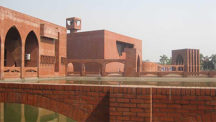
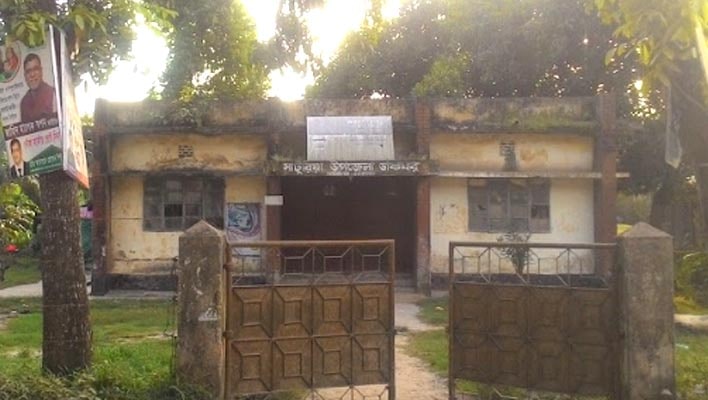
Noakhali at a glance
[Overall Noakhali District Information]
1. Size and location:
Noakhali District is an administrative region in the Chittagong Division in southeastern Bangladesh. The total area of Noakhali district is 4202.60 sq km. Noakhali district is located in the south-eastern part of Bangladesh from 22008 ‘to 23006’ north latitude and from 90053 ‘to 91026’ east longitude. The distance from the capital Dhaka to the district is about 161 km and from the Chittagong divisional headquarters about 138 km. It is bounded on the east by Chittagong district and Feni district, on the north by Comilla district, on the west by Laxmipur district and Bhola district, and on the south by the Bay of Bengal.
2. History of Noakhali District
2.1) Establishment period:
The present Noakhali district was earlier a larger area with Feni, Laxmipur, and Noakhali districts, which is still known as Greater Noakhali. In 182, Warren Hastings, the Governor-General of the East India Company, attempted to introduce the first modern district administration system in the country. He divided the whole of Bangladesh into 19 districts and appointed one collector in each district. Kalinda was one of these 19 districts. This district was formed mainly within the Noakhali region. But in 183 the district system was abolished and the provincial system was introduced and the districts were made subordinate offices of the province. In 18 the district administration system was reintroduced and this time the whole of Bangladesh was divided into 14 districts. Among these 14 there was also a district in the Noakhali region called Bhulua. Later, in 1792, a new district called Tripura was created and Bhuluya was included in it. At that time the mainland of Shahbazpur, Hatia, Noakhali, Laxmipur, Feni, parts of Tripura, Sandwip, and Mirsarai in Chittagong was the Bhulua Parganas. In 18 Bhulua district was renamed as Noakhali district
2.2) Naming:
The ancient name of Noakhali district was Bhulua. The original name of Noakhali Sadar Police Station is Sudharam. According to historians, the northeastern part of Bhuluar was once inundated by the waters of the Dakatia River, which flows from the hills of Tripura, causing extensive damage to crop lands. As a way out of this situation, a huge canal was dug in 180, which diverted water from Dakatia river to Ramganj, Sonaimuri, and Chaumuhani to Meghna and Feni rivers. This huge new canal was called Noah (new) canal in the regional language of Noakhali, as a result of which the region at one time changed in the face of people and came to be known as Noakhali.
2.3) General History:
The active participation of the people of Noakhali in the Wahhabi movement of 1830 and the Khilafat movement of 1920 is one of the events in the history of Noakhali. In 1947, Hindu-Muslim communal riots broke out in different parts of the Indian subcontinent. It was in this context that the tragic persecution and genocide against the Hindu community of Noakhali began, known as the Noakhali riots. During this time Mahatma Gandhi traveled to Noakhali district to see the situation after the riots. At present, there is an ashram named Gandhiji at a place called Jayag in Sonaimuri Upazila, which is known as Gandhi Ashram. Noakhali, Noakhali district with Laxmipur and Feni subdivisions was operating as a large district under Chittagong division. When all the subdivisions were converted into districts in 1984 as per the government decision, Laxmipur and Feni districts became separate. Noakhali district was reorganized with only Noakhali subdivision. At that time there were six Upazilas in this district. Later three more Upazilas were created. Although some parts of Hatia Upazila are connected to the mainland of the district, the greater part (original Hatia) is an isolated island Upazila surrounded by the river Meghna.
2.4) City of Noakhali:
Noakhali is the only district in Bangladesh which has no city of its own name. Noakhali district town is known as Maijdi. When the upazila headquarters was merged with the Meghna in 1947, it was shifted 6 km north and in 1950 the district headquarters was temporarily shifted to Maijdi. The city was rebuilt according to the British plan. When the city of Noakhali was collapsing, the broken office courts of the old city were brought here in the paddy fields and open deserts of Maizdi mouza and in 1953 the old area of the city, Kalitara, Noakhali municipal area was declared in a gazette notification of several mouzas of Qadir Hanif Union including Sonapur and Maijdi. A huge lake is cut across about sixteen acres in the heart of the city. It is commonly known as Bara Dighi. The road of brick Suraki is built in a circle around the lake. All government offices are built in the shape of bungalows around that road. The lake was used primarily as a city reservoir, pumped to supply water to various government offices, courts and residential areas. Although Maijdi was relocated, the issue of official recognition of Maizdi as the headquarters of Noakhali district was controversial for a long time. Finally, in 1972, Maijdi was officially recognized as the permanent headquarters of Noakhali district. Chaumuhani is another busy city and commercial center of Noakhali, which was once famous for its printing and publishing business. Water was supplied to various government offices, courts and residential areas by installing pumps in the lake. Although Maijdi was relocated, the issue of official recognition of Maizdi as the headquarters of Noakhali district was controversial for a long time. Finally, in 1972, Maijdi was officially recognized as the permanent headquarters of Noakhali district. Chaumuhani is another busy city and commercial center of Noakhali, which was once famous for its printing and publishing business. Water was supplied to various government offices, courts and residential areas by installing pumps in the lake. Although Maijdi was relocated, the issue of official recognition of Maizdi as the headquarters of Noakhali district was controversial for a long time. Finally, in 1972, Maijdi was officially recognized as the permanent headquarters of Noakhali district. Chaumuhani is another busy city and commercial center of Noakhali, which was once famous for its printing and publishing business.
2.5) Events of the War of Liberation:
On 22 April 1971, the Pak army entered Noakhali Sadar Upazila. On 11 May the Pak army attacked the town of Hatia. They shot dead six people in Afazia Bazar and two in Ochkhali Bazar of the Upazila. On 15 June, 70 freedom fighters were martyred in a battle with the Pak army at the premises of Sonapur Ahmadia Model High School in the district. On 16 June the Pak army brutally killed 60 innocent villagers at Sreepur village in Sonapur area of Sadar Upazila. On 2 July the freedom fighters attacked the razakar camp of Chandraganj High School in Begumganj Upazila. On 19 August the Pak army killed more than 50 people, including freedom fighters, at Nayahat Bazar in Gopalpur Union of Begumganj. On 4 September 6 freedom fighters were martyred in a battle between the Pak army and the Razakars on the east side of Sluicegate on Bancharam Road in Companiganj Upazila. Later, the freedom fighters fought with the Pak army in this Upazila Eight freedom fighters including Sadar BLF Commander Ahidur Rahman Adud were martyred. On 16 October, the freedom fighters attacked the house of Razakar Jalil in Kabirhat Upazila, killing Jalil and some of his associates. The freedom fighters then attacked the Pak army camp at Domnakandi Primary School in Senbag Upazila. Some freedom fighters were martyred in that battle. Noakhali district became independent on 6 December 1971.
Mohammad Ruhul Amin (1935 – 10 December 1971):
A martyred freedom fighter who participated in the war of independence of Bangladesh. He is one of the seven heroes. He is one of the seven heroes who were awarded the highest military honor of Bangladesh “Bir Shrestha” in recognition of their extreme bravery and outstanding heroism in the great liberation war of Bangladesh. Mohammad Ruhul Amin was born in 1935 in the village of Baghpanchara in Sonaimuri Upazila of Noakhali district. In March 1971, Ruhul Amin was working in Chittagong One day, without anyone noticing, he escaped from the naval base He fled across the border and went to Tripura Joined Sector 2, 6 He actively participated in the war of liberation till September in Sector 2 under the leadership of Major Shafiullah.
Marks of the War of Liberation-
Mass grave: 1 (area adjacent to sluice gate No. 14 of Companiganj Upazila)
Monuments: 3 (Begumganj Upazila Chaumuhani, Sonaimuri Upazila Sonapur and Noakhali District Sadar PTI premises)
Slaughterhouse: 1 (Pond on the east side of Kabirhat High School)
3. Administrative areas:
Noakhali district consists of 9 Upazilas, 9 thanas, 8 municipalities, 93 unions, 72 Mouzas, 96 villages, and 6 parliamentary seats.
3.1) Upazilas: There are a total of 9 upazilas in Noakhali district. The upazilas are-
| No. | Upazila | Area
(sq km) |
Administrative police station | Areas covered | |
| 1 | Kabirhat | 189.94 | Kabirhat | Municipality (1): Kabirhat | |
| Unions (7): Narottampur, Sundalpur, Dhansindri, Ghoshbagh, Chaprashirhat, Dhanshalik and Batia. | |||||
| 2 | Companiganj | 305.33 | Companiganj | Municipality (1): Basurhat | |
| Unions (8): Sirajpur, Char Parbati, Char Hazari, Charkankara, Char Fakira, Rampur, Musapur and Char Elahi | |||||
| 3 | Chatkhil | 133.89 | Chatkhil | Municipality (1): Chatkhil | |
| Unions (9): Sahapur, Ramnarayanpur, Parakot, Badalkot, Mohammadpur, Panchgaon, Hatpukuria, Ghatlabagh, Noakhala and Khilpara. | |||||
| 4 | Noakhali Sadar | 552.46 | Sudharam | Municipality (1): Noakhali | |
| Unions (13): Charmatua, Dadpur, Noyannai, Kadirhanif, Binodpur, Noakhali, Dharmapur, Aojbalia, Kaladarap, Ashwadia, Niazpur, East Char Matua, and Underchar. | |||||
| 5 | Begumganj | 426.05 | Begumganj | Municipality (1): Chaumuhani | |
| Unions (18): Amanullahpur, Gopalpur, Jirtali, Alaiarpur, Chayani, Rajganj, Eklashpur, Begumganj, Mirwarishpur, Narottampur, Durgapur, Kutubpur, Rasulpur, Hajipur, Sharifpur and Kadirpur. | |||||
| 6 | Subarnachar | 329.26 | Subarnachar | Unions (8): Char Jabbar, Char Bata, Char Clark, Char Wapda, Charjubali, Char Amanullah, East Char Bata, and Mohammadpur. | |
| 7 | Senbagh | 155.83 | Senbagh | Municipality (1): Senbagh | |
| Unions (9): Chhatarpaiya, Kesharpar, Dumurua, Kadra, Arjuntala, Kabilpur, Mohammadpur, Bijbagh and Nabipur. | |||||
| 8 | Sonaimuri | 170.42 | Sonaimuri | Municipality (1): Sonaimuri | |
| Unions (10): Jayag, Nadna, Chashirhat, Bargaon, Ambernagar, Nateshwar, Bajra, Sonapur, Deoti, and Amishapara. | |||||
| 9 | Hatia | 1508.23 | Hatia | Municipality (1): Hatia | |
| Unions (11): Harani, Chanandi, Sukhchar, Nalchira, Char Ishwar (excluding Bhasanchar), Charking, Tamarddi, Sonadia, Burirchar, Jahajmara, and Nijhumdwip. | |||||
| Bhasanchar | Union (part 1): Bhasanchar of Char Ishwar Union |
3.2) Parliamentary seats:
| Parliamentary seats | National constituency | Member of Parliament | Political party |
| 26 Noakhali-1 | Chatkhil Upazila and Sonaimuri Upazila (excluding Bargain, Ambernagar, and Nateshwar Unions) | Mr. H. M. Ibrahim | Bangladesh Awami League |
| 269 Noakhali-2 | Bargaon, Ambarnagar, and Nateshwar Unions of Sonaimuri Upazila and Senbagh Upazila | Mr. Morshed Alam | Bangladesh Awami League |
| 260 Noakhali-3 | Begumganj Upazila | Mr. Mamunur Rashid Kiran | Bangladesh Awami League |
| 261 Noakhali-4 | Noakhali Sadar Upazila and Subarnachar Upazila | Mr. Mohammad Ekramul Karim Chowdhury | Bangladesh Awami League |
| 282 Noakhali-5 | Kabirhat Upazila and Companyganj Upazila | Mr. Obaidul Quader | Bangladesh Awami League |
| 263 Noakhali-6 | Hatia Upazila | Mr. Ayesha Ferdous | Bangladesh Awami League |
3.1) Administrative Structure (Brief):
| Creation of Noakhali district | 1821 |
| Geographical location | 220 06 / to 220 18 / north latitude and 900 36 / to 910 35 / east longitude |
| Volume | 4202.60 sq km |
| Population | 33,60,251 |
| Population density | 601.93 per sq km |
| Total family | 5,04,552 |
| Number of parliamentary seats | 06 |
| Upazila | 09 |
| Total number of voters | 18,32,71 (Male: 6,69,908, Female: 6,52,754) |
| Police station | 09; Investigation center-02, outpost-06 |
| Union | 91 |
| Village | 6 |
| Mouza | 946 |
| Union Land Office | 75 |
| Municipality | 08 (Basurhat, Kabirhat, Senbagh, Chaumuhani, Noakhali, Chatkhil, Sonaimuri, Hatia) |
| Education rate | ৬৯.৫০% |
4. Population:
According to the 2011 census, the total population of Noakhali district is 33,60,251. Of these, 18,10,444 are males and 17,59,608 are females. Male to female ratio is 92: 100. It has a population density of 743 sq km and a birth rate of 1.63%. The capital, Maijdi, has a population of 64,585; Males constitute 51.50% of the population and females 48.50%. The population density here is 5915 / sq km. According to the religion, 95.42% of the total population of the district is Muslim, 4.52% is Hindu and 0.06% is Buddhist and follow other religions.
5. Education system:
| University | 01; Public University (Noakhali University of Science and Technology) |
| Medical College | 01; (Noakhali Abdul Malek Ukil Government Medical College) |
| College of Textile Engineering | 01 |
| Police Training Center | 01 |
| College | 35 government-06 private-26 |
| Secondary school | 26 government-12 private-265 |
| Elementary school | 1243 government-6 private-329 |
| Satellite – 72 communities – 6 | |
| Madrasa | 161 seniors – 30 Dakhils and 131 scholars |
| Agricultural Training Center | 02 T-College-01 Law College-01 |
| Technical institute | 05 (Youth Training 02, PTI-01, Technical School and College-02) |
6. Notable educational institutions are:
| Noakhali Government College | Noakhali District School |
| Noakhali Government Women’s College | Noakhali Government Girls High School |
| Begumganj Textile Engineering College | Noakhali Technical Training Center |
7. Health system:
| General Hospital | 01 |
| Medical Training Center | 01 |
| Upazila Health Complex | 06 |
| School Health Clinic | 02 |
| TB Clinic | 01 |
| Electro-medical workshop | 01 |
| Service Institute | 01 |
| Subsidiary health center | 31 |
8. Economy:
The economy of Noakhali district is mainly dependent on agriculture. About 40% of the regional GDP comes from the agricultural sector and 80% of the people in the district are involved in this profession. In agriculture, most people are mainly involved in fish farming and fishing. Throughout the year, about 70-80 percent of the workers are involved in boat building and repair, fishing, processing, transportation, dry goods production, net repair. Being a lowland region, the district is rich in fish farming, which plays a huge role in the economy of the region. Crop production is basically once a year. During the winter season, various crops are cultivated all over the district, especially in the vast char areas of the south. Cattle, buffalo, goat, and sheep rearing have also become widespread in vast pastures and islands.
Industrial factories were not well developed in Noakhali district, but many people in Noakhali district have earned a reputation as established businessmen of the country. They have set up big industrial factories in different parts of the country. The people of Noakhali travel extensively in the country and abroad for work. A large number of people from the district are working in different countries of the world including the Middle East and Europe. Noakhali district is one of the top remittance sending districts in Bangladesh.
Other sources of income in the district include non-agricultural labor 3.43%, industry 0.64%, trade 14.64%, transport 3.63%, employment 18.11%, construction 1.49%, remittances. .96% and others contributed 10.56%.
08. Communication system:
The main roads of communication in Noakhali district are Dhaka-Noakhali highway and Chittagong-Noakhali highway. All types of vehicles can be contacted. The district also has a rail link.
09. Religious places of worship:
Noakhali district has 4159 mosques, 496 Eidgah, 239 temples, 2 monasteries, and 1 Catholic Christian church.
10. Climate and nature:
The average annual temperature is 34.3 degrees Celsius and the minimum average is 14.4 degrees Celsius. The average annual rainfall is 3302 mm.
11. Rivers:
The main river of Noakhali district is Meghna. Among the notable rivers are Dakatiya and Chhota Feni.
12. Natural Disasters:
Since 1890, Noakhali district has been hit by cyclones, floods, tornadoes, cyclones, and other natural calamities. The devastating cyclone of 1970 killed about one million people, many of them in Noakhali district.
13. Places of interest:
| Nijhum Island | Maijdi Court Building Dighi |
| Nijhum Island National Park | Shaheed Bhulu Stadium |
| Bajra Shahi Mosque | Police Training Center, Noakhali |
| Bir Shrestha Shaheed Mohammad Ruhul Amin Library and Memorial Museum, Sonaimuri | Noakhali Public Library, Maijdi |
| Gandhi Ashram | Mangrove forest, char Jabbar |
| Mahatma Gandhi Museum | Samadhi Ashram of Thakur Ramchandra Dev, Chaumuhani |
| Musapur closure | Kalandi zamindar’s house |
| Chairman Ghat | Kalindi Public Durga Temple |
| Golden Island | Yaqub Ali Dealer Jame Mosque, Sonapur |
| Dighi of Kamala Rani | Ramzan Mia Jame Mosque |
| Noakhali District Jame Mosque | Dargah of Mr. Mizi (Rah.) Except Fakir, Maizdi |
14. Masterpiece personality:
| Mohammad Ruhul Amin – A heroic freedom fighter with the title of Bir Shrestha. | ATM Shamsuzzaman –– Actor. |
| Munir Chowdhury –– Martyred intellectual. | Ferdousi Majumder –– TV actress. |
| Zahurul Haque –– Agartala is one of the martyrs in the conspiracy case. | Mostafa Sarwar Farooqi – Film director, producer, screenwriter, and playwright. |
| Abdul Malek Lawyer –– Lawyer and Politician. | Shabnam Bhubali –– Film Actress. |
| Obaidul Quader –– Politician. | Abdul Hakim –– Medieval poet. |
| Shirin Sharmin Chowdhury –– The first woman speaker of the country. | Chittaranjan Saha –– Publisher and organizer of Bangla Academy Book Fair. |
| Kabir Chowdhury –– Academician, essayist, and translator. | Pranab Bhatt – Lyricist and novelist. |
| Hossain Chowdhury of Motah –– Academician and writer. | Mahfuz Ullah –– Writer, journalist, television personality, and environmentalist. |
| Farah Mahbub –– Justice. | AHM Touhidul Anwar Chowdhury –– Freedom Award-winning physician. |
| Badrul Haider Chowdhury –– Lawyer and former Chief Justice. | Tabarak Hussain –– Diplomat. |
| Abu Belal Mohammad Shafiul Haque –– Former Army Chief. | Sirajur Rahman –– British journalist. |
| Moin Uddin Ahmed –– Former Army Chief. | Hemprabha Majumdar –– Personality of the anti-British independence movement in the Indian subcontinent. |
| Shahadat Hossain Chowdhury –– Retired Army Officer and Commissioner of Bangladesh Election Commission. | Anisul Haque –– Politician. |
| Sadat Hussain – Former Chairman of Bangladesh Public Service Commission and a heroic freedom fighter. | Arjumand Banu –– Politician. |
| Kamrul Ahsan is currently the Ambassador of Bangladesh to Russia. A secretary to the government. Earlier, Bangladesh had ambassadors to Canada and Singapore. | Ayesha Ferdous –– Politician. |
| Mofazzal Haider Chowdhury –– Martyred intellectual. | Mohammad Ekramul Karim Chowdhury –– Politician. |
| Mohammad Sharif –– A heroic freedom fighter with the title of Bir Pratik. | HM Ibrahim –– Politician. |
| Mohammad Abul Bashar – A heroic freedom fighter with the title of Bir Bikram. | Mamunur Rashid Kiran –– Politician. |
| Abul Kalam Azad – A heroic freedom fighter with the title of Bir Bikram. | Mahbubur Rahman –– Politician. |
| ASM Shahjahan –– Former Inspector General of Police and former Adviser to the caretaker Government. | Morshed Alam –– Politician. |
| Ataur Rahman –– TV actor. | Sirajul Alam Khan –– Politician. |
15. Miscellaneous:
| The amount of land | 6,75,129 acres (Agriculture-4,96,561 acres, Non-Agriculture-2,7,548 acres) | ||||||||||
| Working NGO | 50 | ||||||||||
| Annual average rainfall | 260 inches | ||||||||||
| Coastal area | 50 km | ||||||||||
| Coastal dams | 348.98 km | ||||||||||
| Cyclone Shelter | 210 animal forts – 36 | ||||||||||
| Coastal forest | 11,17,899.38 hectares | ||||||||||
| Orphanage | 63 Growth Centers – 30 | ||||||||||
| Tubewell number | 1,21,63 | ||||||||||
| Bank branch | 135 | ||||||||||
| Hat / Bazaar | 238 | ||||||||||
| Places of interest |
|
Main agricultural crops
Paddy, khesari, sugarcane, mug, potato, chilli, soybean, groundnut, watermelon, vegetables, and various types of pulses.
Extinct or nearly extinct crop
Sesame, linseed, jute, rice of Sahaniya variety, mung dal, etc.
Main fruits:
Mango, jackfruit, litchi, banana, coconut, papaya, palm, betel nut, etc.
Extinct or almost extinct traditional vehicles
Palanquin, horse, cart, and buffalo cart. Main exports Coconut, betel nut, paddy, Hooghly leaf mat, dried fish.


